Alaska – Juneau – BEEN THERE GOT THE T-SHIRT

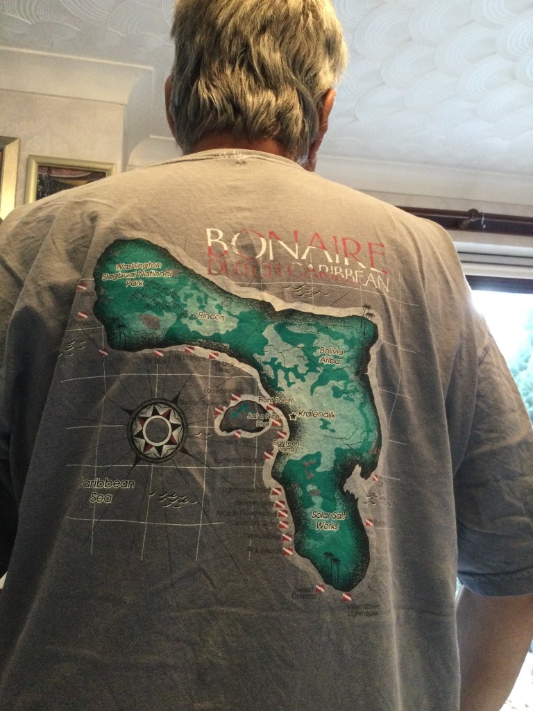
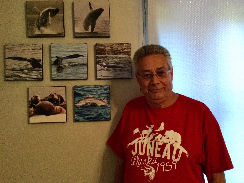
Been there got the t-shirt

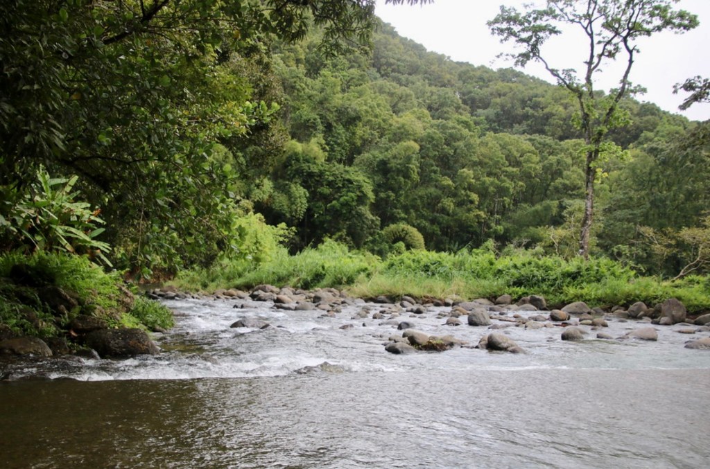
The delightful town of Juneau is the official capital of the USA State of Alaska. It is situated on the Gastineau Channel …an area Cruisers call the inside passage. It is both a coastal and a mountain town which is rich in both culture and wildlife.

It was named in 1881, after gold prospector Joe Juneau and it became the designated  capital of Alaska in 1906. It covers an area of 3,255sq miles, of which only 14sq miles are inhabited by approx 32,400 people.

One of Juneaus unique features is that you can not drive to it. The rugged mountain ranges surrounding Juneau make it impossible to access by road. People either fly in, arrive by ferry or like many visitors arrive by cruise ship. 

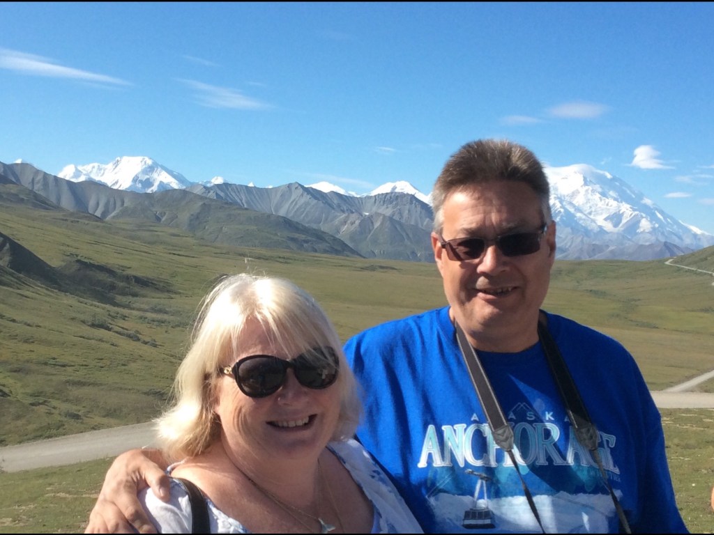
We have been fortunate to visit Juneau on many different occasions. This has meant we have visited most of its attractions :- 

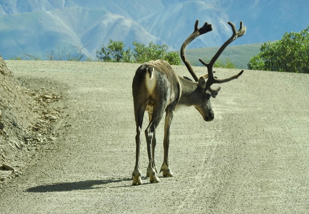
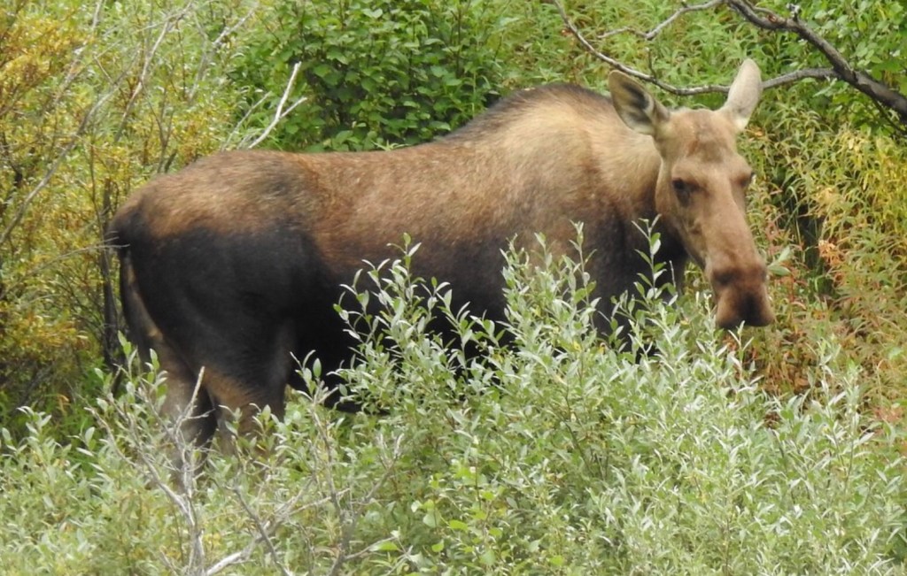
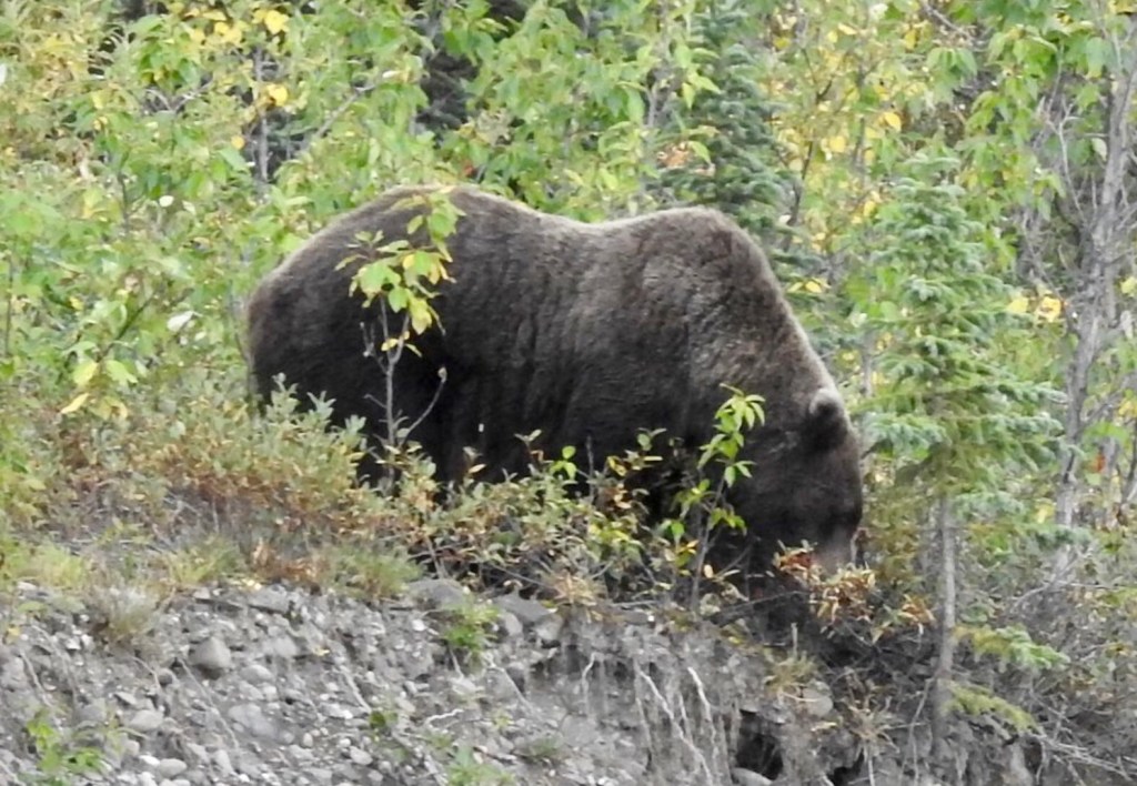
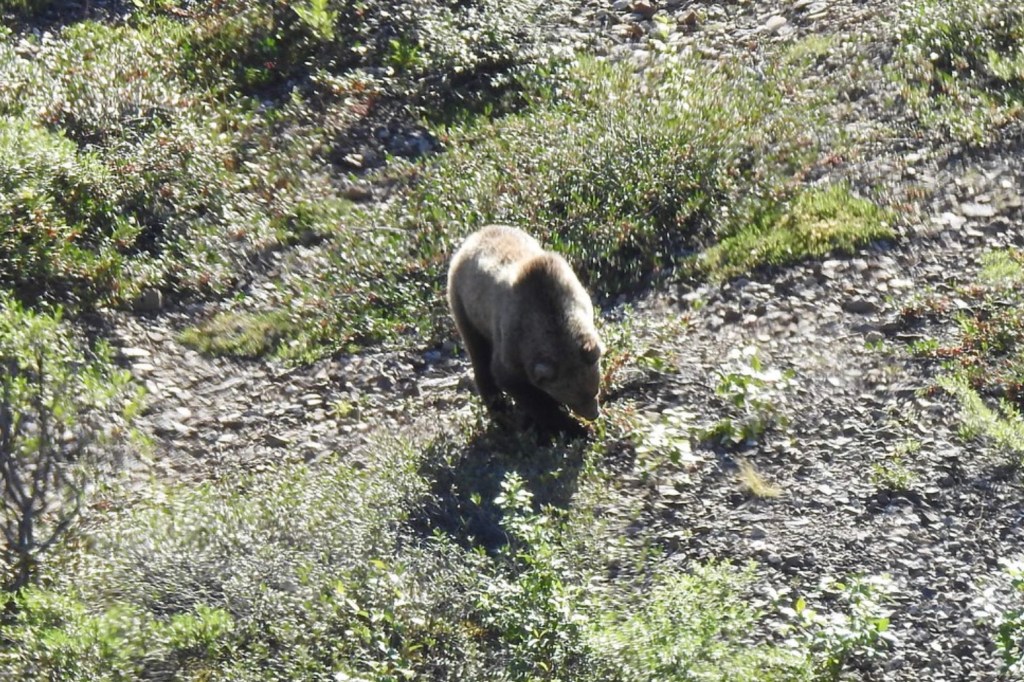
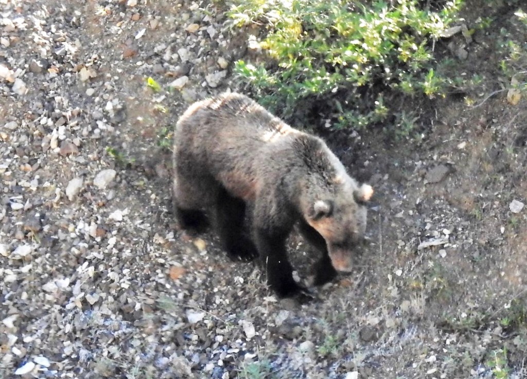
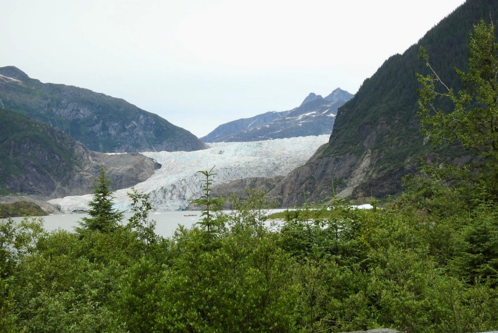
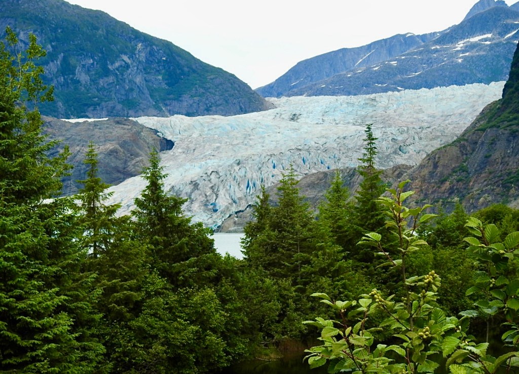
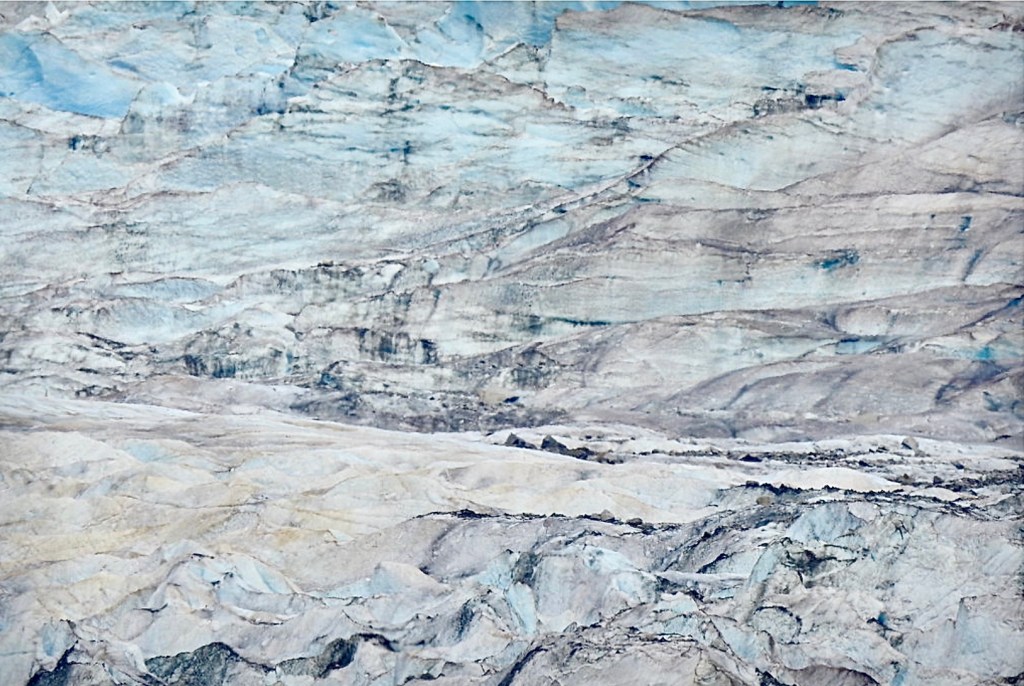
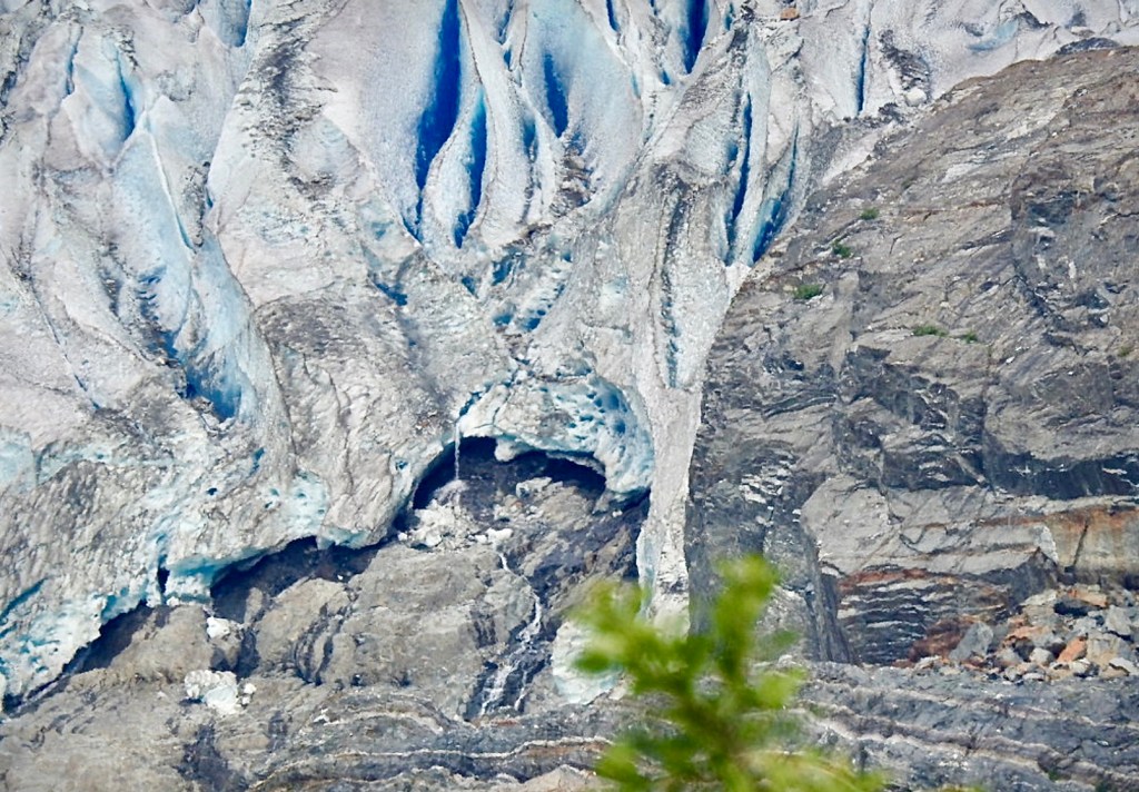
The beautiful Mendenhall Glacier is only 12 miles from the centre of Juneau and is a very popular attraction. Visitors  enjoy a variety of activities here including hiking, wildlife viewing, and exploring the Mendenhall Glacier Visitor Center. On one occasion when we visited the UK BBC had just finished filming bears during the salmon spawning season from the raised wooden walkway along the river at the foot of the glacier. Lots of people choose to glacier walk here. We, however, like walking the wooden platforms looking for bears. We’ve been lucky a couple of times and even luckier to see a porcupine rattle past us. 

The Mount Roberts Tramway is another visitor attraction. Although there is usually a long queue it moves quickly and it never seems crowded at the top . The tramway is a quick and scenic ride to the top of Mount Roberts, from here you can enjoy panoramic views of Juneau and the surrounding area.

The Salmon Hatchery is extremely interesting. You learn all about Alaska’s important salmon industry, the 5 different types of Salmon and you get to see salmon up close.

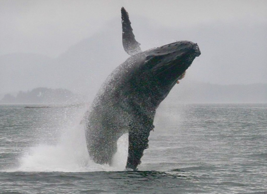
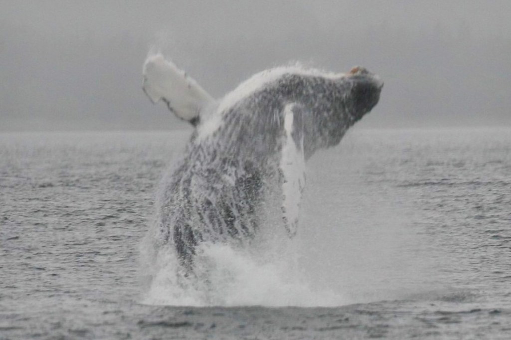
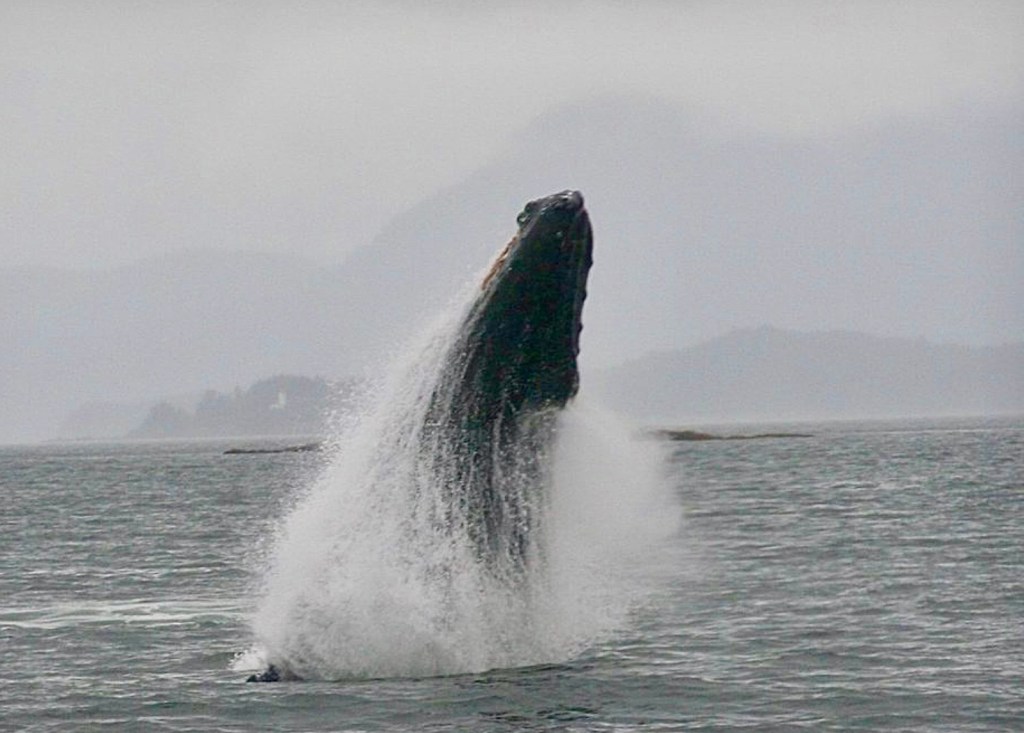
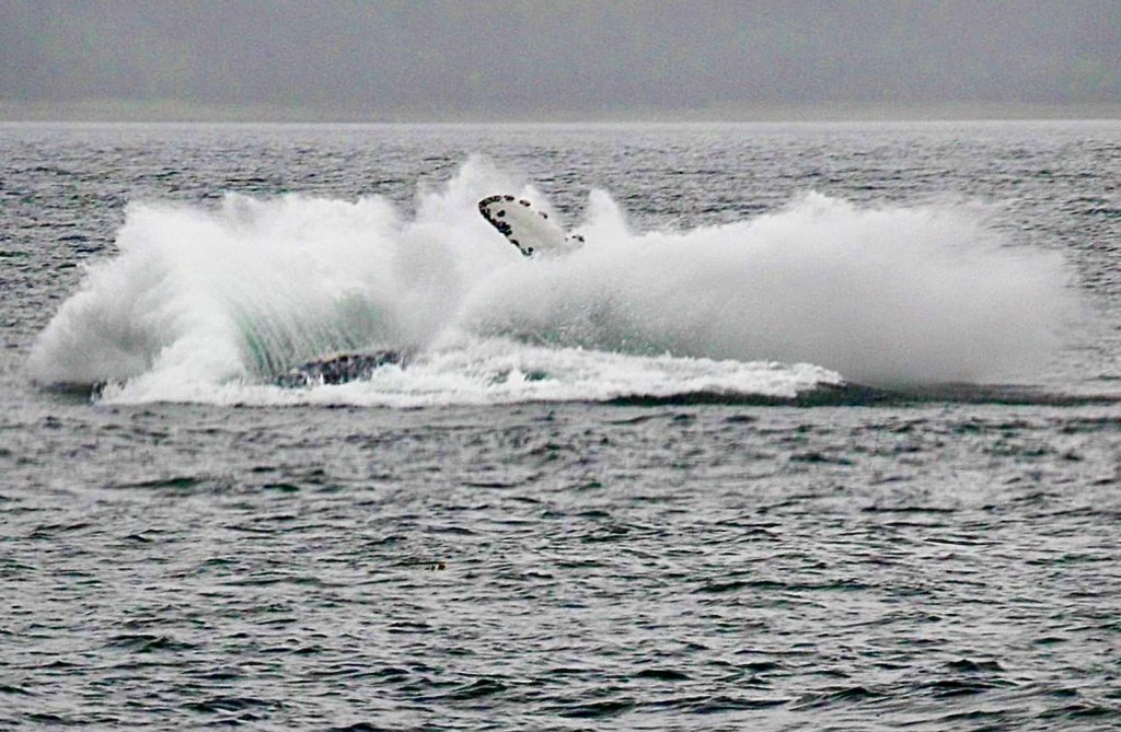
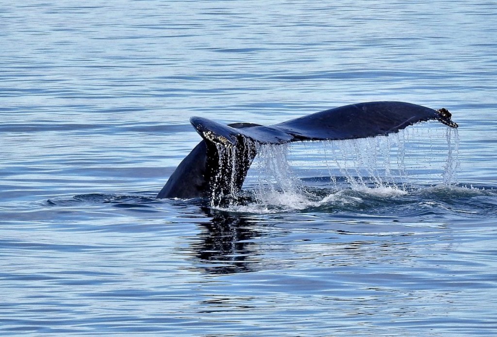
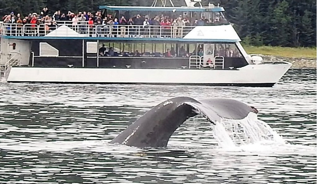
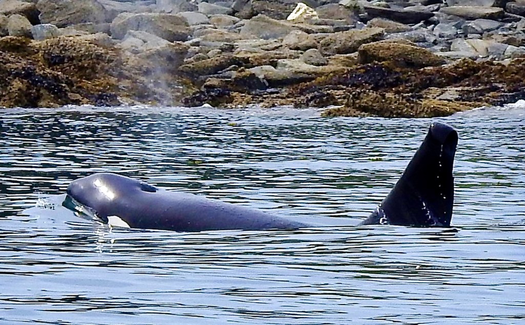
Our favourite activity which we do every time is Juneau is Whale Watching. Juneau is a great place to spot humpback whales and killer whales (orcas), especially between April and November. We take a tour boat out in Auke Bay. The company we always use guarantee that we will see whales or they will give you your money back. We’ve never had to have  a refund because we have always seen whales…..splendid sightings…

Grand Cayman Island – Caribbean – BEEN THERE GOT THE T-SHIRT.

The Cayman Islands, are British Overseas Territory covering  264-square-kilometre (102-square-mile). They comprise of 3 islands in the western Caribbean Sea. The island we have visited on a couple of occasions is Grand Cayman. It is the largest island and well known for its beach resorts and varied scuba diving and snorkelling sites.  The 2nd largest Cayman Island is Cayman Brac which is a popular place for deep-sea fishing excursions. Little Cayman, the smallest island, has interesting diverse wildlife, including endangered iguanas to seabirds such as red-footed boobies. The capital is George Town, on Grand Cayman.

Grand Cayman, the largest and most populous island, is about 22 miles (35 km) long and 8 miles (13 km) across at its widest, with a total area of 76 square miles (197 square km). 

We arrived by Princess cruise ship and tendered in to shore and embarked on our ships tour of the island. 

Our tour included a sightseeing trip around George Town.

We then visited the Turtle farm at Boatswain’s Beach. At this eco-sensitive attraction, there are 100 round pools containing turtles at different developmental stages. There are small baby turtles, a 600-pound giant turtle, and everything in between. All the turtles have been raised at the farm with the hope of increasing the population and preventing them from being hunted to extinction…….the sign at the Centre says …’ The Cayman Turtle Centre maintains a small population of Kemp’s Ridley’s, the most endangered sea turtle. In 1980, in response to fears that this critically endangered species could disappear completely from the wild and to ensure genetic preservation, yearlings were brought from Mexico to here to start a breeding colony. In 1984 the Cayman Turtle Centre became the first place in the world to successfully breed captive reared Kemp’s Ridley’s. In April 1999, 110 Kemp’s were sent back to Mexico to continue the cooperative research project which started in 1979’.

We had such fun learning about the turtles and we were taught how to hold them and how they really like their neck stroked…it was a very special couple of hours.

There were also some very photogenic lizards basking in the heat of the sun.

Our tour continued along Seven Mile Beach. The beautiful Seven Mile Beach lies along the Caribbean Sea and has white, soft sand and gentle waves. There are plenty of places to hire a sun-lounger and parasols and indulge in a nice cool drink. 

Our next stop was Hell. Hell is at the top of most visitors’ itineraries. Hell is where you can see the beautiful volcanic like spike rock formations.  This is what Hell says about the rock formations …..”The sharp grey coloured pinnacled surface of the Caymen formation dolostone referred to as phytokarst, ………..This erosion has left an eerie and desolate looking landscape that earned this location its highly appropriate name. “

There is also the famous post office from where you can mail a letter back home post marked from Hell…….which of course we did…however only 3 of the 5 we posted arrived in England and we had been home 4 weeks before they turned up !!!!!!

John spoilt me here and bought me a gold pendant with a circular ball of the dolostone in the middle. 

One of the islands delicacies is the famed rum cake, we stopped at the Tortuga Rum Cake Company for a tasty morsel.

What a wonderful visit to an interesting Island we had, had…

Our next trip to the Caymen Islands we decided to revisit the Turtle Centre and this time we went across the road to the Dolphin Sanctuary. All the dolphins have been  rescued and due to their medical needs they are very used to human interaction.  To fund their keep and further rescues they run Dolphin Experiences…. We were given life jackets and had been told to wear swimming costumes and swim shoes. We stood up to our chests  on a ledge in a very large area of water. There was a mother and calf and the mother came and greeted us all by shaking our hands, rising out of the water to a raised hand, kissing us and rubbing our cheeks. After our individual experience the mother returned to the other end of the area and proceeded to teach her calf how to leap and twist and turn out of the water…it was an amazing sight.

Another wonderful experience on Grand Cayman Island….we were sad to leave but it was only ‘au revoir’…until the next time. 

Martinique – French Caribbean Island – BEEN THERE GOT THE T-SHIRT

Martinique is an island in the Lesser Antilles which is part of the French West Indies, in the eastern Caribbean Sea. Its nearest neighbours are the island republics of Dominica 22 miles (35 km) to the northwest, and Saint Lucia 16 miles (26 km) to the south. Guadeloupe another part of overseas France, lies about 75 miles (120 km) to the north 

As an overseas region of France, its culture reflects a distinctive blend of French and West Indian influences. Its largest town, Fort-de-France, features steep hills, narrow streets and La Savane, a garden bordered by shops and cafes. In the garden is a statue of island native Joséphine de Beauharnais, first wife of Napoleon Bonaparte.

Martinique is in effect a dependant region of France and therefore enjoys the same European Union benefits as the French Mainland. Unlike a lot of Caribbean islands It has the same modern day infrastructure, education, health and welfare system as France. 

It’s a delightful island to visit. We have been fortunate enough to cruise into port here on several occasions. On one occasion we decided to explore the heart of the island in a 4-wheel-drive vehicle to the interior rainforest and backcountry.  Our tour took us passed banana and sugar cane plantations, fording streams and encountering all variety of vegetation en route to a river deep in the rainforest. Upon arrival, we experienced the peace and tranquility of a remote, hidden spot deep in the inner forest. 

We listened to the sounds of the jungle and observed nature’s beauty all around us.

We sat and relaxed in the inner forest area known as Coeur Bouliki. The rich volcanic soil nourishes banana plantations and pineapple fields as well as mangoes, papayas, lemons, limes, and West Indian cherries and we sat enjoying a fruit drink and eating fresh fruit off banana leaf platters. 

The only thing which impeded the peace and tranquility was a cat having an altercation with a cockerel ….Surprisingly the cockerel came off the best and the cat legged it …

Exploring the area by having a short walk to the river we saw some superb plants and magnificent flowers. We also saw land frogs and lizards

Your return drive took us on another route which took us through banana plantations.

We stopped at a Rum Distillery  and tasted some of the islands rums. They are known as some of the best rums in the world on the island of Martinique. Many have been bestowed with the Appellation d’Origine Contrôlée (AOC) award.

We continued our sightseeing on the way back to the Cruise Ship.

Bonaire, Caribbean- BEEN THERE GOT THE T-SHIRT

Bonaire is a Caribbean island which forms part of the ABC islands. Aruba, Bonaire and Curaçao are three islands closely located which are all special municipality’s within the Kingdom of the Netherlands in the western most group of the long arc of Islands, known as the  Lesser Antilles in the Caribbean Sea.

Bonaire lies 50 miles (80 km) north of the Venezuelan coast and 20 miles (32 km) east of Curaçao. The capital is Kralendijk.

The northern part is hilly, with a peak, Brandaris, 787 feet (240 metres) high, while the southern part is flat, with desert like vegetation.

We have cruised into Bonaire on numerous occasions. However they have recently introduced a US$75 per person visitor tax so less cruise ships are stopping at this delightful island. This is perhaps why the tax has been introduced as some Caribbean Islands dislike the influx of thousands of tourists who arrive by cruise ship and spend very little of the much needed foreign exchange, which boosts their economy. They are perhaps trying to encourage the single destination holiday maker who stays in their hotels, eats in their restaurants and gets a greater understanding of the eco-systems they are trying hard to protect.
There is lots to do and see on Bonaire and our trips have included visiting Goto Lake. This used to be a well known area for large flamboyances of flamingo. However every time we have visited there have only been a couple and the main Flamboyance have now made Pink Brine Lake their home. Goto lake is still a charming, picturesque place to visit.

The island grows a lot of cactus. In the centre of Rincon The Cadushy Distillery can be found. It makes a unique Cactus liqueur which has won awards and has created another tourist destination.

During our tour we saw several wild donkeys. These were originally used for labour by the Spanish, who brought them over with them, in the 17th Century. As modern technology took over these animals were no longer required and left to roam wild. there is a Donkey Sanctuary on Bonaire which also attracts tourists.

We have thoroughly enjoyed touring around Bonaire and seeing its many varied sights.

On leaving the Island by Cruise ship you get a great view of the salt pans and the piles of extracted salt. Since the Dutch gained power in the 17th Century, salt has been an important export. The extraction declined at the end of slavery. Today it is once again in full production after the industry was revived by Cargill’s a Canadian company.

Screenshot

Denali Nation Park, Alaska- BEEN THERE GOT THE T-SHIRT

Denali is the highest peak, 20,310 feet high,  in North America. It is situated in the central area of Alaska 237 miles north of Anchorage, and 120 miles south of Fairbanks. Mount Denali has a north and south summit. They were both snow-capped at the time of our last visit. However climate change has altered this and suggests that the view we had is unlikely to be repeated.

It is also the name of the National Park. Denali National Park is 6 million acres(24,000sq Km) of wild land, with one winding road. We call it the road to nowhere!!

We have been fortunate to visit it several times. On arriving in the town, the first time, we went to a show which was not only very well acted but also very informative.

We decided to do a full day trip into the park. Half day trips transverse the lowest elevations which is mostly forestry areas for approximately 15 mi (24 km) of the road. These lower elevations are covered in trees and contribute to the fact that in Alaska there are at least 40,000 trees for each Alaskan resident. Through our experience we have learnt that this lower elevation area doesn’t attract as much wild life as you can see deeper into the National Park. We have seen occasional Moose, Caribou and Grizzly Bears this low.

A full days tour in a school  bus, goes deeper into the park on to the tundra of the middle elevations. Several portions of the road run alongside sheer cliffs that drop hundreds of feet at the edges. There are no crash barriers. As a result of the danger involved, and because most of the gravel road is only one lane wide, drivers have to  be trained in procedures for navigating the sharp mountain curves and yielding the right of way to wild life,  opposing buses and park vehicles. On one occasion we got in a traffic queue with a slow moving Caribou who walked down the middle of the road for several kilometres with our bus trundling along behind it.

This park road runs north of and roughly parallel to the imposing Alaska Range. Only the start  of the road is paved because both permafrost and the freeze-thaw annual cycle would create a very expensive maintenance programme for a paved road.

Denali National park was formally known as Mount McKinley National Park. The name was subject to local criticism, as the mountain was originally named after a newly elected US president in 1897 and the park was named Mount McKinley National Park when it was created in 1917. The local Alaskan people wanted it called Denali because it means  “the great one” or “the high one,” Denali plays a central role in the creation myth of the Koyukon Athabascans, a Native Alaskan group that has lived in the region for centuries. For many years the local people tried to get the name changed. Much to most peoples delight  on August 30, 2015 President Barak Obama directed the Secretary of the Interior to rename the mountain Denali. The higher elevations of the park are covered with snow, glaciers and bare rock. In the winter people dog-sledge, cross-country ski and snowmobile in the park which is home to numerous wildlife including grizzly bears, wolves, foxes, moose and Caribou.

The top of Mount Denali is often shrouded in cloud, we have, however, been fortunate to see it on a couple of occasions on beautiful clear days.